Connections


See the bigger picture. Instead of seeing London as a collection of separate fragments, see how it links up. I have cycled all the possible routes and these are the best I have found.
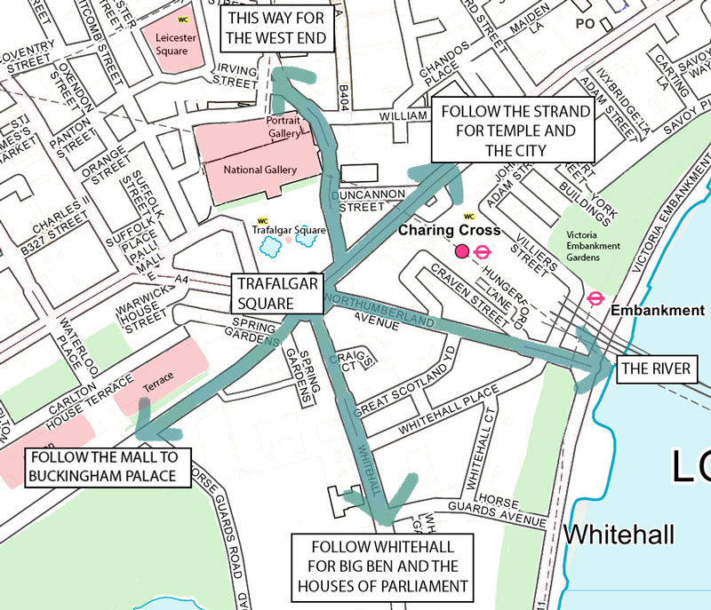
This map shows Trafalgar Square as a central point from which to orientate yourself
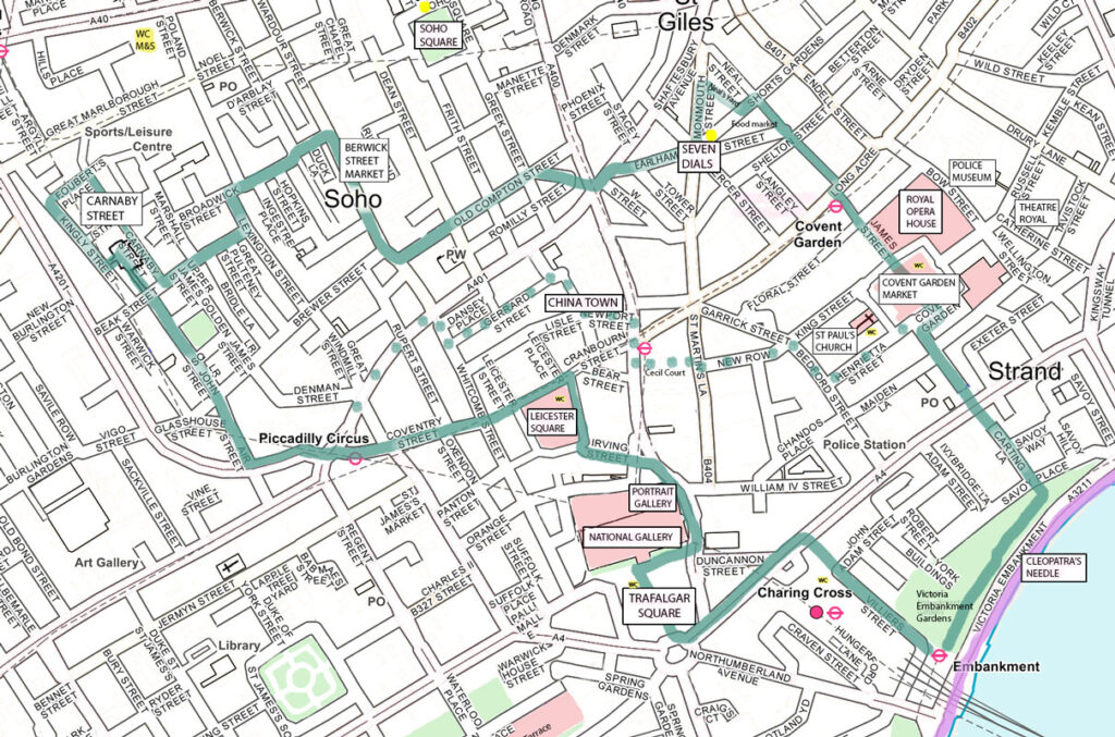
A lovely walk starting and finishing at Embankment tube station. It gives a taster of the West End including Trafalgar Square and Piccadilly Circus, Soho and Covent Garden, and ending by the river. If you would rather include China town and finish at Piccadilly Circus tube station, follow the dotted line alternative route when you reach Covent Garden.
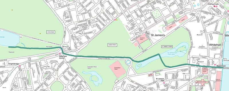
There is a straight route through the parks directly to the river, where you can cross Westminster Bridge and continue your walk along the south bank. Notice that the walk passes Buckingham Palace.
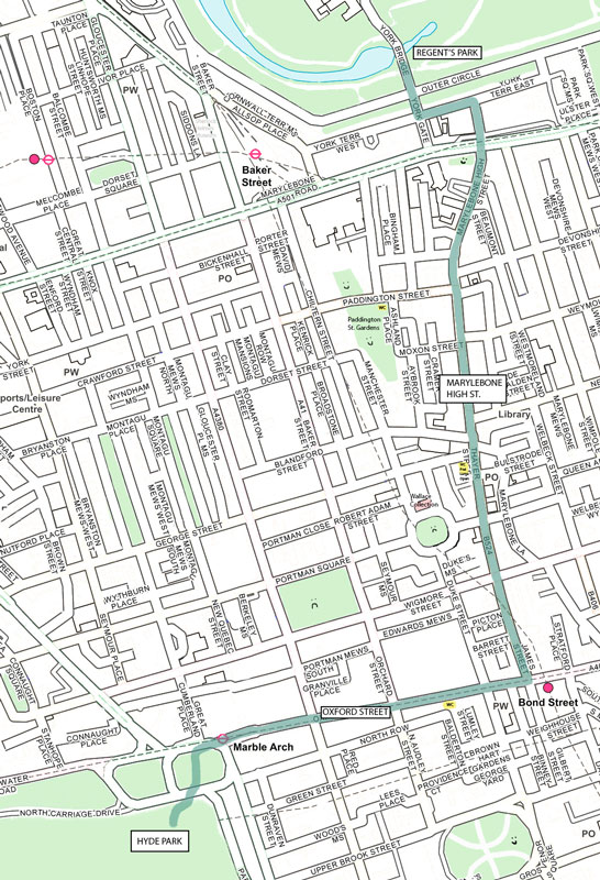
This is the best route through Marylebone. Take in a bit of Oxford Street then turn left into James Street with its eateries, continuing straight up into the upmarket and charming Marylebone High Street.
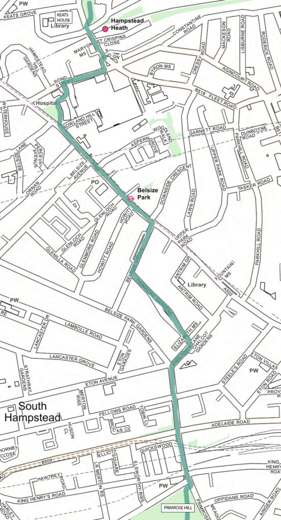
Part 1: The route takes you through Belsize Park
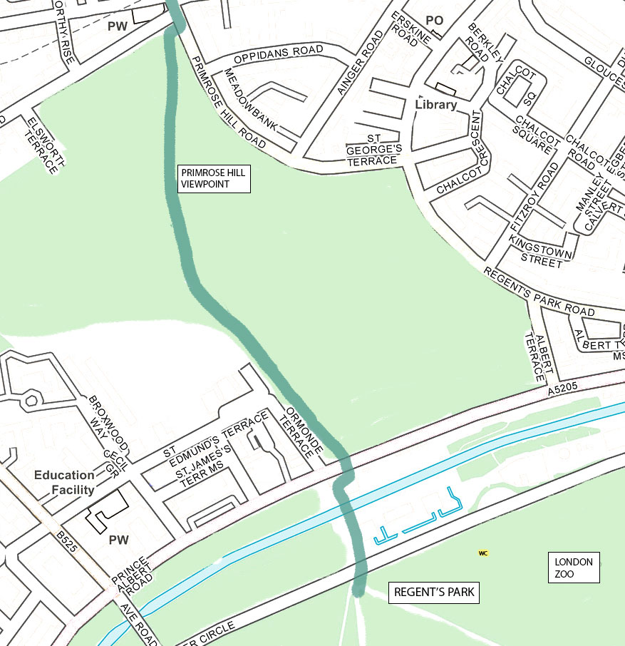
Part 2: here is a great view over London from Primrose Hill.
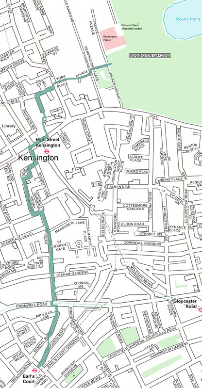
Earl’s Court tube is in zone 2 so if you are arriving from the west you can avoid paying to enter Zone 1 and have a lovely walk through the parks into the West End. Watch out for the little snicket off Kensington High Street just before the Ivy restaurant on the left. This is a cut-through across a lovely little hidden park to Holland Street.

Back to Top